PDF3D ReportGen and PDF3D.IO development SDK can be used to convert geospatial formats to 2D and 3D PDF.
The conversion may maintain a coordinate system and allow for measurement. For some users there may be legal, copyright or confidential protection considerations which make this undesirable. PDF3D has a feature which obscures measurements and will help protect your designs.
- Firstly, the units specified on the model can be changed on the Conversion tab - Output Coordinate System. If your model is in “mm”, change this to yards or miles.

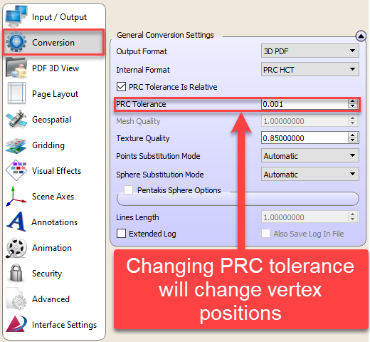
- On the Conversion tab set PRC Tolerance value to a slightly higher number, such as 0.001 to introduce vertex position rounding to a limited level of precision.
- Introduce some geometric distortion in the output 3D model, by using the Interface Settings tab, enable Object Scale and orientation. Set the general scale value to a random number, such as PI, and one of the component coordinates to an invisible amount of skew such as 1.003. On older revisions this may require the Animation Tab “Exploded” option to be enabled to “unlock” the scale changes.


- Enable Assembly-Depth filtering to 1, to merge as many small parts into larger meshes.

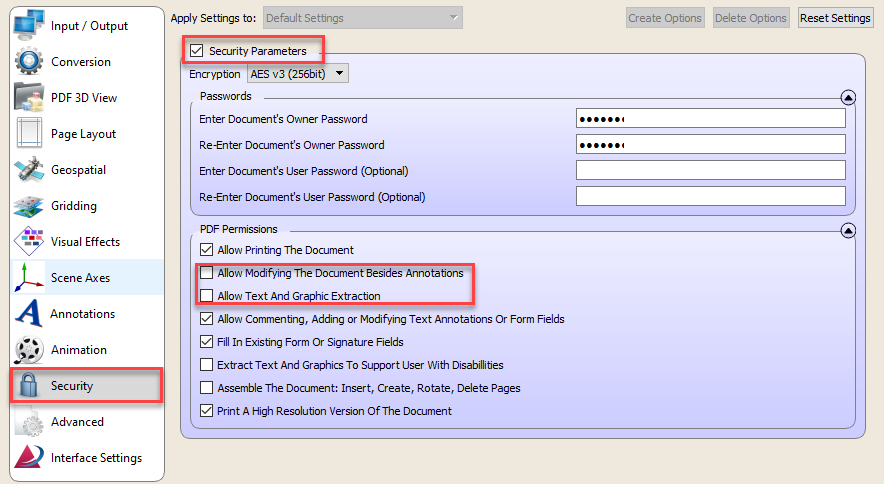
- Finally, set your preferences on the Security tab to inhibit 3D model extraction.